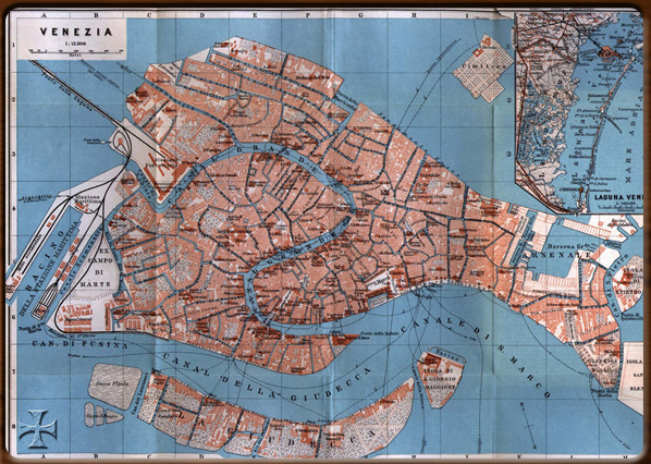
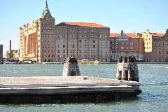
Unlike almost all cities on the mainland, which have now lost all traces of their early industrialisation on account of modern expansion, Venice still retains most of the signs of its recent industrial past . In fact, the city has expanded along the edges of the lagoon as it has grown, precisely where many mainland companies transferred their operations at the end of the 19th Century, attracted by the efficient railway and port infrastructure, such as the Mulini Stucky mills that relocated from Treviso to Giudecca on account of the wharves and docks, cranes and suction plant.
Others moved close to the docks, such as the Cotonifico Veneziano cotton mill, thus ensuring guaranteed supplies of raw materials and access to all major foreign markets. Again, new businesses developed along the eastern and southern edges of the city, needing open spaces and direct access to the water: the shipyards at Castello were attracted by the presence of the Arsenale, itself a centuries-old “machine”.
Others favoured the Giudecca area (mills, pasta factories, breweries, textile mills, cement factories, rope-makers and clockmakers) for its wide open spaces.
The way Venice has grown over the last hundred years is, therefore, largely due to the needs of industry and complementary businesses, as well as to contemporary urban facilities needed by the city: the slaughterhouse, the gasworks and the aqueduct. The rate at which the city has grown is quite amazing if one considers that the early factories and workshops (not including the Arsenale) covered an area of 70 hectares, roughly one hundred times the size of St. Mark’s Square.
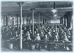
The buildings were often very impressive, providing jobs for many people (400 workers at the Fonderie Neville steelworks, never less than 500 at the two Cantieri Navali sites in Giudecca and Junghans, 730 at the Saffa factory, more than 1,000 at Cotonifico Veneziano and almost 2,000 at the Manifattura Tabacchi tobacco plant) .
Venice is thus an exception to the rule when it comes to the provincial capitals of Veneto: all the others seem content with a consolidated bureaucratic or administrative role. Compared to the relatively static mainland with its few isolated suburban areas, Venice can boast continuous expansion and a concentration of business initiatives thanks to a clever infrastructure policy (railways and the port), first introduced by the Austrian Government. This old city has thus become one of Italy’s most industrialised areas in the space of a few decades, leading to inevitable repercussions on the urban framework and the environmental context (the lagoon) .
The industrialisation of Venice is also the result of a process that has been going on for more than a century, although the most important industrial complexes were built over the last twenty years of the 19th Century and the early 20th Century. Immediately before this period, small businesses were fairly evenly distributed throughout the city, often located within existing buildings. They had yet to form specialised areas of production, except for the concentration of glassworks on Murano. However bigger businesses with a higher degree of specialisation gradually relocated to the suburbs, especially to the West of the city, having been attracted by the railway and port infrastructure, as well as facing less local and political resistance to building new and larger production facilities.
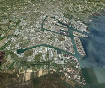
Although Venice already had the Arsenale and Murano (two very early examples of the city/factory), its outskirts along the lagoon became crowded with chimneys, cranes, glass and iron roofing, red brick buildings, airports and docks, all animated by the daily movement of ships, barges, rail cars, freight wagons, goods and, of course, the workers. A new landscape was in the making: along the north edge of Giudecca; on the new island of Sacca Fisola; in the West where the new Porto Commerciale docks and the Stazione Marittima railway station were planned; further on, in Cannaregio and up to the edge of the nineteenth century extensions of the Arsenale and even a few sites between San Pietro and Sant’Elena. A typically industrial landscape in some aspects, but at the same time its unique lagoon background is obvious. The industrial area then spread out towards the centre, but met with terrific resistance owing to the old fabric of the city. Yet there were still a few opportunities that were quickly snatched up: in Giudecca, Cannaregio and Santa Marta. The result is a surprising sequence of images due to a combination of the classic Venetian landscape (canals, fondamenta, small buildings and palaces, churches, campi, sottoportici and typically industrial architecture.
Early industrialisation of Venice stopped (for the time being) along the edges of the city and lagoon. Nevertheless, it could not be ruled out that industrial development would one day reach the centre of the city: proof of this were the insistent attempts to expand the railway into the centre, first along the Fondamenta delle Zattere to Punta della Salute (the Jappelli project, 1850), then along the southern edge of Giudecca to San Giorgio (the Lavezzari-Romano-Saccardo project, 1868).
Not to mention the regularly submitted bold proposals for the "modernisation" of the city: how to connect the island of Giudecca with the centre via an underwater tunnel or avoid the Mercerie by building a suspended bridge from St. Mark’s to Rialto.
Then again, industry penetrated the city in other ways thanks to the gradual introduction of manufactured products: iron bridges, like the nineteenth century ones over the Canal Grande at Accademia and Scalzi (since demolished) and new street furniture (cast iron lanterns, railings and parapets) .
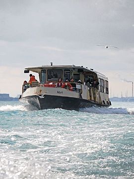
The same goes for on the water, hitherto the absolute dominion of wood, the maritime material par excellence: steamers instead of sailing ships and motor boats instead of ferries, speedboats rather than gondolas, leading to a more intensive use of the canals and basins, now with new cast-iron and glass piers.
Meanwhile there were a series of minor initiatives to adapt the city of Venice to its new productive role rather than a few major interventions, a veritable revolution in terms of functionality: the rail link with the mainland, the opening of "Strada Nuova", the formation of the "city" between Rialto and St. Mark’s, major pedestrianisation of the city by filling in many canals and the construction of new bridges, and the building of more important urban facilities (the slaughterhouse, the gasworks and the aqueduct).
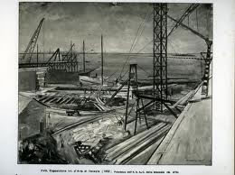
Most important of all, the new port that symbolised the shift in the industrial zone, now outside the actual city: in fact, deeper canals had to be dug to the bocche di porto to accommodate the new steamships, while dams had to be built at Lido and Malamocco. A new canal would soon have to be dug inland, leading to the creation of Porto Marghera.
Indeed, Porto Marghera was developed in response to growing demand for new port facilities and industrial space in the Venice area, already considered one of the most promising industrial “poles” in Italy at the end of the 19th Century.
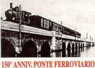
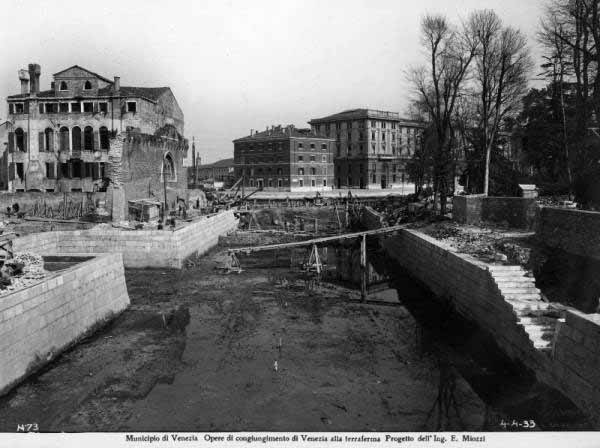
At the turn of the century, the western part of the city facing the mainland had already changed greatly (in function and appearance). The rail terminal meant that new infrastructure, buildings and facilities typical of a genuine port area and industrial zone arose in this district. The uncertain natural border with the lagoon, consisting of rows of houses and lands along the "beach" of Santa Marta and the vast triangular desert of the former Campo di Marte, was quickly replaced by the buildings and plant needed for the Stazione Marittima railway station (operational since 1880): with two new piers and an internal basin (built on the basis of information provided in 1867 by the "Paleocapa Commission"), the station was separated from the city by Canale della Scomenzera, but joined via an iron bridge at the western end of Canal Grande.
Warehouses, sheds, cranes and silos immediately arose in the area, followed by the oil storage tanks transferred from their previous location in Sacca Sessola in the 1890s.
Later developments spread out eastwards from this major port area, i.e. in the direction of the city. The Punto Franco (1892) and the Magazzini Generali warehouses (1896) occupied the docks at the end of Canale della Giudecca, soon served by rail connections crossing the new iron bridge over Canale della Scomenzera. These were quickly followed by factories and industrial works, filling up the spaces between the port and the old city: the Cotonificio Veneziano cotton mills (1883) between the Punto Franco and the Magazzini Generali; the gasworks in the vast triangle of Campo di Marte; the aqueduct in the nearby area of Sant’Andrea (1884), supplied by the new underwater pipeline coming from the mainland and continuing right up to the former Manifattura Tabacchi tobacco plant, one of the most important factories in the city at the time.
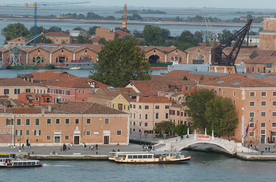
An impressive complex of factories and industrial plant also developed, completely encircling the western border of the city. To the North beyond the railway station, in Cannaregio, the Saffa factory, the Mulino dei Grani Passuello e Provera mills and smaller factories in the vast area in front of the Macello Comunale slaughterhouse, later occupied by the Linetti factory. To the South, on the other side of the Canale della Giudecca, the massive Mulini Stucky mills (1883), the Distilleria Veneziana distillery (1902) and the huge warehouses in Sacca Fisola, later demolished to make room for a residential district after the Second World War.
This new extensive concentration of factories and port facilities became as large and important as the old Arsenale, though this too adapted to new production and shipping requirements with the building of the first big dry dock (1875).
The Arsenale, however, was still very much a military structure, guaranteeing great output and high employment levels (3851 employees in 1887). It was decided not to turn it into an industrial area, with private shipyards and workshops, despite several proposals to do so at the time. Moreover, its location to the West of the city was, by this time, no longer “central” owing to the concentration of infrastructure on the eastern side of town thanks to the indispensable presence of the railway. However, new port facilities were built in the late 1890s making it possible for the nearby port entrance of San Nicolò del Lido to become an active industrial area.
It was inevitable, therefore, that the major port roads and canals left from the eastern side of town.
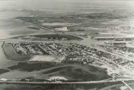
Indeed, excavation of the new canal in the direction of Marghera was part of the expansion plan for the port facilities at the beginning of the 20th Century. The original plans (the Petit project, 1902, and the Rossi-Cucchini project, 1903) identified the nearby barena of Bottenighi (less than 4 kilometres from the Marittima railway station as the crow flies) as a prime location for further development of the port. It offered limitless potential and easy, more efficient rail connections with the station of Mestre.
This marked the start of Porto Marghera and, as a result, the new modern city on the mainland.
Franco Mancuso